


Teledyne e2v’s Space Imaging division previously supplied the ultraviolet laser CCD detector to the ESA Aeolus ALADIN instrument, leading to a follow-on programme Aeolus-2.
Chelmsford, UK, April 20, 2021 – Teledyne e2v, a part of the Teledyne Imaging Group, and a Teledyne Technologies [NYSE:TDY] company, has been contracted by the European Space Agency (ESA) to develop an improved version of the previously supplied CCD69 detector. Utilizing the experience and data available from the ESA Aeolus mission, hosting the first Doppler Wind Lidar in space, Teledyne e2v will further enhance the performance and sensitivity of the ultraviolet detector that could ultimately be deployed in the next-generation space-based Doppler Wind Lidar instruments.
Teledyne e2v provided the CCD69 detector for the Aeolus mission, currently in orbit gathering atmospheric wind profiles across the Earth, launched on 22nd August 2018.
The Aeolus wind observations have had a significant positive impact on weather forecasts and are used by several weather centres today, Dr. Anne Grete Straume-Linder, Aeolus mission scientist at ESA, explained during the Appleton Space Conference in December 2020. This has led to an interest by EUMETSAT and ESA member states for a possible future operational Doppler Wind Lidar Meteorological mission. Phase A/B1 instrument activities and Phase A operations and ground segment activities are therefore on-going at ESA and EUMETSAT.
Aeolus’ ALADIN instrument, the first satellite mission to provide profiles of Earth’s winds, works by emitting an ultraviolet laser beam through the Earth’s atmosphere and measuring the reflected return signal from air molecules and particles (aerosols and hydrometeors) in the atmosphere. Teledyne e2v, in collaboration with Airbus Defence & Space and ESA, developed an innovative type of detector that simultaneously measures the travel time and Doppler-shift of the returned ultraviolet laser pulse to resolve the atmospheric wind speed at different altitudes along the instrument line-of sight. from the surface or top of optically thin clouds up to about 30 km altitude. This technique also allows for the detection of thin aerosol and cloud layer and the top altitude of thick clouds.
The returned signal is typically extremely weak, however the detector has the capability to add together a number of returned pulses to improve the accuracy of the measurements. Aeolus is the first satellite of its kind to utilize this type of technology in space.
Prof. Paul Jerram, Chief Engineer at Teledyne e2v commented: “We are proud that unique technology from Teledyne e2v is at the heart of a mission that is improving the quality of weather forecasts around the world and excited to be developing the next generation detector that will produce even better quality, higher resolution data that will provide further improvement to climate science.”
Aeolus’ data is being distributed publicly to forecasting services and scientific users across the world in less than three hours of sensing, and is used in the daily forecasts of several European weather centres and in particular the UK’s Met Office.
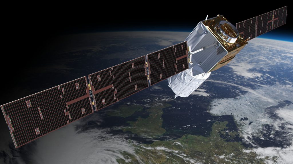
Top image: Aeolus is the first space mission to acquire profiles of the wind on a global scale. These near-real time observations will improve the accuracy of numerical weather and climate prediction and advance our understanding of tropical dynamics and processes relevant to climate variability.
Photo credit: ESA/ATG medialab


